Physical History
A GIS Approach to World History
By Mark Ciotola
First published on May 17, 2019. Last updated on January 19, 2021.
Graphical Information Systems (GIS) can be used to analyze spatial aspects of societies, as well as their progression and interaction with concurrent societies over time.
The Colossus world history grid was superimposed on an image of the Europe, Africa and Asia. GIS was utilized to better understand the relations between societies. Spatial connections between adjacent or nearby societies were identified. Each connection was discounted for distance and terrain factors. It is possible to study correlations found in the Colossus model with such factors.
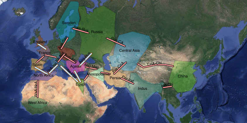
Satellite image of Asia showing political entities and possible connections (photo layer: credit Google)
« The Colossus Model of World History | COURSE | Modern Times and the Near Future »