Digital History
Obtaining, Processing and Analyzing Satellite Imagery for Historical Uses
By Mark Ciotola
First published on August 24, 2019. Last updated on June 13, 2024.
Learning Objectives
- Students will learn about how both current and semi-historical (past 70 years) satellite imagery can be used to for historical purposes, such as locating and examining historical remains of past societies as well as current/recent regional terrains.
- Students will learn the capabilities and limitations of satellite imagery, how to obtain imagery, how to process it and analyze it.
- Identify sources of satellite images
- Download and use several software packages to open, examine and process different types of images and remote sensing information.
Prerequisites
- Knowledge of computers and patience.
- Preferred: knowledge of how use a command line utility, especially for Linux/Unix.
Introduction
Obtaining, processing and analyzing satellite imagery for can be a valuable tool set for historians. It allows you to literally be an armchair archeologist. It also gives you some idea of what the geographical features are of a historical region (with the caveat that sometimes that changes over time).
This workshop introduces several tools for examining, processing and analyzing satellite images. Having your own laptop will be beneficial, since you can download and install the applications and files during the workshop and help each other. Be warned that some of these files and applications are large. Having at least a few gigabytes of free disk space is a necessity.
Example
Blue Marble Images of Silk Road
Historical Analysis With Remote Sensing
Introduction
Pyramids, palaces, great walls, entire ancient cities, and even Milwaukee’s Mitchell Park botanical domes…some people prefer their objects of material culture to be colossal! Numerous macro-material objects of historical interest can be observed utilizing satellite imagery and remote sensing. Many large geographic features, such as river areas and mountains have not changed greatly over time. Much in history can be illustrated and analyzed using satellite images, especially if one delves deeper than a mere visual sweep.
Fortunately, there has recently been a copious avalanche of freely-available satellite imagery by the National Aeronautics Space Administration, European Space Agency, Google and other parties. There is also an abundance of free tools and techniques that can greatly enhance the ability to employ such imagery to characterize large historical objects. There is even additional remote sensing data that allows historians to peer beneath the Earth’s surface down into the secrets of covered ruins. The digital historian merely peers: no digging is required!
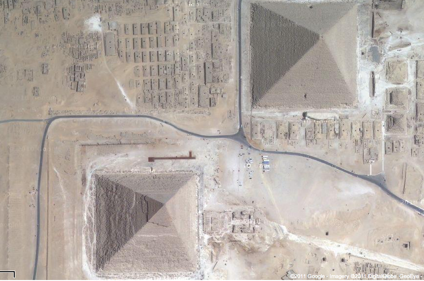
Credit: Google Earth
Sources
- Sources of free satellite imagery from government sources (Landsat, Sentinel, EOSDIS) and private sources (Google, Planet).
- Approaches to obtain proprietary imagery for free
- NASA Earthdata
- Earthdata Human Dimensions
- Human Dimensions data
- Earth Data visualization tool
- Moderate Resolution Imaging Spectroradiometer (MODIS) site
Tools
Easy-to-use, high-level tools to use and manipulate satellite imagery:
Image Analysis
Advanced image analysis and manipulation tools will be briefly introduced, such as Python image libraries, SNAP, HDF and TNTmips.
Activities
- Students will start by using simple tools such as Google Earth to locate and examine areas of historical interest.
- Students will obtain government-provided satellite images.
Further Reading
- SustainSat cubesat and satellite imagery information and education